Croatian Islands
Škoji - The Croatian Islands
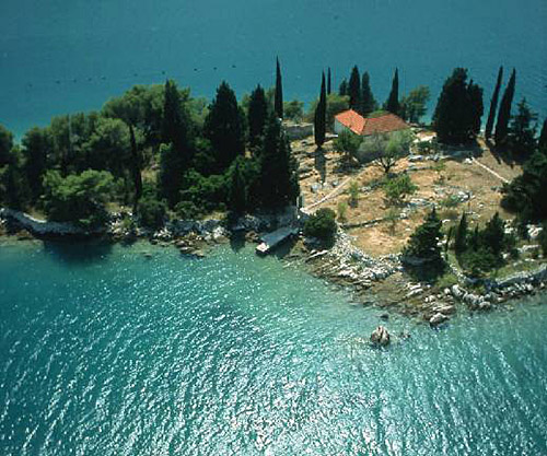
Vela Sestrica (Korcula) Island
Vela Sestrica (Korcula) island Info
The population on the island is 0 inhabitants with total area on the island 11183 square meters. The population density is 0 inhabitants per square kilometer. The hightest peak on the island is meters. The island is accessible by public transport (ferries).More information:
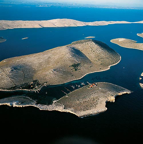
Sestrice - twin islands called " Vela Sestrica " and " Mala Sestrica" (Large and Small Sister). The lighthouse on the island of Vela Sestrica was built in 1871 by Autro-Hungarian Empire which used to be home of lighthouse master and his family until very recently. The buildings is now deserted as navigation lights are automated.
| GPS Latitude | 42.96236700 |
|---|---|
| GPS Longitude | 17.20789100 |
| Population | 0 |
| Area(M2) | 11183 |
| Coastline Lenght(M) | 388 |
| Highest peak | |
| Population density | 0 |
Vela Sestrica (Korcula) GPS coordinates
GPS location coordinates: 42°57'44.5"N 17°12'28.4"ESome Lighthouses in vicinity of Vela Sestrica (Korcula):
- Sestrica vela (Korcula) Lighthouse in Islet Vela Sestrica near Korcula at a distance of 0.01 miles.
- Sucuraj Lighthouse in Sućuraj, Hvar Island at a distance of 11.24 miles.
- Glavat Lighthouse in Islet Glavat near Lastovo at a distance of 13.94 miles.
- Plocica Lighthouse in Islet Plocica near Korcula at a distance of 20.32 miles.
- Struga Lighthouse in Skrivena Luka, Lastovo Island at a distance of 23.20 miles.
- Sveti Petar Lighthouse in Makarska at a distance of 25.06 miles.
- Sveti Nikola Lighthouse in Pucisca, Brac island at a distance of 36.43 miles.
Marinas in vicinity of Vela Sestrica (Korcula):
- ACI Marina Korcula at a distance of 3.61 miles.
- Marina Solitudo (Lastovo) at a distance of 23.86 miles.
- Marina Ramova ( Baska Voda) at a distance of 27.44 miles.
- Marina Baska Voda at a distance of 30.30 miles.
- ACI Marina Vrboska (Hvar) at a distance of 30.76 miles.
Neighbouring islands to Vela Sestrica (Korcula):
- Mala Sestrica (Korcula) Island at 0.18 miles away.
- Gojak Island at 0.47 miles away.
- Majsanic Island at 0.66 miles away.
- Majsan Island at 0.81 miles away.
- Mala Stupa Island at 0.81 miles away.
- Vela Stupa Island at 1.00 miles away.
- Skrpinjak Island at 1.60 miles away.
- Sutvara Island at 1.71 miles away.
- Bisace Island at 1.82 miles away.
- Lucnjak Island at 1.89 miles away.
Nearest Campsites to Vela Sestrica (Korcula):
- Paradiso Campsite is at distance of 1.30 miles
- Ponta Campsite is at distance of 1.32 miles
- Adriatic Campsite is at distance of 1.33 miles
- Trstenica Campsite is at distance of 1.36 miles
- Vala Campsite is at distance of 1.37 miles
Vela Sestrica (Korcula) Nearby Hotels:
- Holiday Resort Adriatic in Orebić at a distance of 1.32 miles
- Apartments Villa Orebic in Orebić at a distance of 1.36 miles
- Apartments Kati in Orebić at a distance of 1.41 miles
- Apartmani Posejdon in Orebić at a distance of 1.48 miles
- Apartments Cale in Orebic at a distance of 1.49 miles
- Boutique Hotel Adriatic in Orebić at a distance of 1.56 miles
