Croatian Islands
Škoji - The Croatian Islands
Sutvara Island
Sutvara island Info
The population on the island is 0 inhabitants with total area on the island 97674 square meters. The population density is 0 inhabitants per square kilometer. The hightest peak on the island is meters. The island is accessible by public transport (ferries).More information:
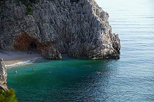
Sutvara is island located at the very East of Korcula Archipelago, Peljesac channel, Croatia. It is an unpopulated island. There are old quarries on the island of Sutvara too, as well as vineyards that belong to family form Lumbarda. There is also a tiny pebble beach on the western side of SUtvara, suitable for children.
| GPS Latitude | 42.94023300 |
|---|---|
| GPS Longitude | 17.19290600 |
| Population | 0 |
| Area(M2) | 97674 |
| Coastline Lenght(M) | 1299 |
| Highest peak | |
| Population density | 0 |
Sutvara GPS coordinates
GPS location coordinates: 42°56'24.8"N 17°11'34.5"ESome Lighthouses in vicinity of Sutvara:
- Sestrica vela (Korcula) Lighthouse in Islet Vela Sestrica near Korcula at a distance of 1.71 miles.
- Glavat Lighthouse in Islet Glavat near Lastovo at a distance of 12.29 miles.
- Sucuraj Lighthouse in Sućuraj, Hvar Island at a distance of 12.76 miles.
- Plocica Lighthouse in Islet Plocica near Korcula at a distance of 20.01 miles.
- Struga Lighthouse in Skrivena Luka, Lastovo Island at a distance of 21.59 miles.
- Sveti Petar Lighthouse in Makarska at a distance of 26.19 miles.
- Sveti Nikola Lighthouse in Pucisca, Brac island at a distance of 37.13 miles.
Marinas in vicinity of Sutvara:
- ACI Marina Korcula at a distance of 3.12 miles.
- Marina Solitudo (Lastovo) at a distance of 22.38 miles.
- Marina Ramova ( Baska Voda) at a distance of 28.54 miles.
- ACI Marina Vrboska (Hvar) at a distance of 30.89 miles.
- Marina Baska Voda at a distance of 31.38 miles.
Neighbouring islands to Sutvara:
- Skrpinjak Island at 0.16 miles away.
- Bisace Island at 0.61 miles away.
- Gubavac (Korcula) Island at 0.72 miles away.
- Knezic Island at 1.05 miles away.
- Vrnik Island at 1.13 miles away.
- Gojak Island at 1.26 miles away.
- Majsan Island at 1.29 miles away.
- Planjak Island at 1.30 miles away.
- Kamenjak (Korcula) Island at 1.44 miles away.
- Majsanic Island at 1.44 miles away.
Nearest Campsites to Sutvara:
- Vela Postrana Campsite is at distance of 1.62 miles
- Trstenica Campsite is at distance of 2.49 miles
- Glavna plaza Campsite is at distance of 2.57 miles
- Kalac Campsite is at distance of 2.68 miles
- Nevio Campsite is at distance of 2.86 miles
Sutvara Nearby Hotels:
- Apartments Lumbarda Beach in Lumbarda at a distance of 1.42 miles
- Pension Bebic in Lumbarda at a distance of 1.50 miles
- Apartments Villa Olea in Lumbarda at a distance of 1.59 miles
- Pension Lovrić in Lumbarda, Korčula at a distance of 1.59 miles
- House Maris in Lumbarda at a distance of 1.62 miles
- Apartments Mate Cebalo in Lumbarda at a distance of 1.63 miles
