Croatian Islands
Škoji - The Croatian Islands
Vela Stupa Island
Vela Stupa Island Info
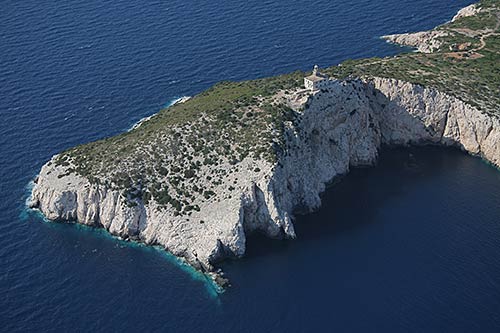
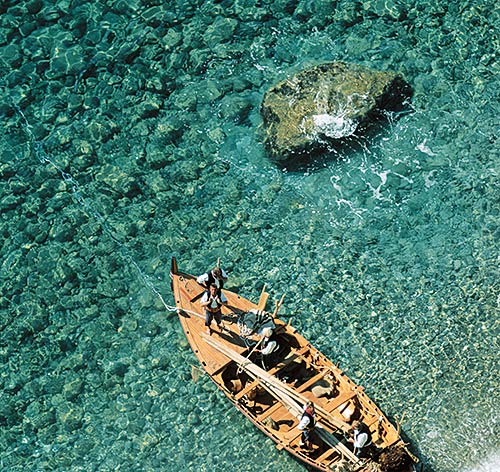
Vela Stupa is an unpopulated island with total area of 16411 square meters (m2). The lenght of its coastline is 504 meters. There is no public transport to Vela Stupa.Stupe are two small islands, one much larger than another, that are located at the further East of Korcula archipelago. On the largest one, named " Vela Stupa" , there is a small konoba restaurant that is conveniently situated for visitors to the Archipelago to enjoy food and drinks. This small restaurant, run by local family, has reputation as a good place to eat. Stupe is also popular with naturist (people that like nude swim and sunbath) who come here in summer to enjoy sea and sun.
| GPS Latitude | 42.96288000 |
|---|---|
| GPS Longitude | 17.18810000 |
| Area(M2) | 16411 |
| Coastline Lenght(M) | 504 |
Vela Stupa GPS coordinates
GPS location coordinates: 42°57'46.4"N 17°11'17.2"EVela Stupa Video
Some Lighthouses in vicinity of Vela Stupa:
- Sestrica vela (Korcula) Lighthouse in Islet Vela Sestrica near Korcula at a distance of 1.00 miles.
- Sucuraj Lighthouse in Sućuraj, Hvar Island at a distance of 11.20 miles.
- Glavat Lighthouse in Islet Glavat near Lastovo at a distance of 13.78 miles.
- Plocica Lighthouse in Islet Plocica near Korcula at a distance of 19.34 miles.
- Struga Lighthouse in Skrivena Luka, Lastovo Island at a distance of 22.53 miles.
- Sveti Petar Lighthouse in Makarska at a distance of 24.64 miles.
- Sveti Nikola Lighthouse in Pucisca, Brac island at a distance of 35.76 miles.
Marinas in vicinity of Vela Stupa:
- ACI Marina Korcula at a distance of 2.61 miles.
- Marina Solitudo (Lastovo) at a distance of 23.07 miles.
- Marina Ramova ( Baska Voda) at a distance of 27.00 miles.
- Marina Baska Voda at a distance of 29.85 miles.
- ACI Marina Vrboska (Hvar) at a distance of 29.87 miles.
Neighbouring islands to Vela Stupa:
- Mala Stupa Island at 0.19 miles away.
- Majsan Island at 0.36 miles away.
- Majsanic Island at 0.36 miles away.
- Gojak Island at 0.80 miles away.
- Lucnjak Island at 0.89 miles away.
- Rogacic Island at 0.96 miles away.
- Vela Sestrica (Korcula) Island at 1.00 miles away.
- Mala Sestrica (Korcula) Island at 1.17 miles away.
- Badija Island at 1.33 miles away.
- Skrpinjak Island at 1.43 miles away.
Nearest Campsites to Vela Stupa:
- Trstenica Campsite is at distance of 0.92 miles
- Glavna plaza Campsite is at distance of 1.00 miles
- Nevio Campsite is at distance of 1.39 miles
- Paradiso Campsite is at distance of 2.08 miles
- Ponta Campsite is at distance of 2.08 miles
Vela Stupa Nearby Hotels:
- Boutique Hotel Adriatic in Orebić at a distance of 0.84 miles
- Apartments Villa Orebic in Orebić at a distance of 0.85 miles
- Apartments Lada in Orebic at a distance of 0.93 miles
- Apartments Cale in Orebic at a distance of 0.95 miles
- Apartmani Posejdon in Orebić at a distance of 0.97 miles
- Apartments Kati in Orebić at a distance of 1.01 miles
