Croatian Islands
Škoji - The Croatian Islands
Badija Island
Badija Island Info
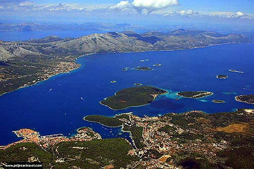
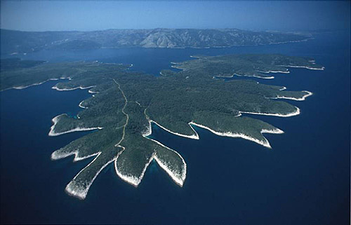
Badija is an unpopulated island with total area of 970827 square meters (m2). The lenght of its coastline is 4158 meters. There is no public transport to Badija.Badija is the nearest island, where the sports - recreation centre was situated in the buildings of the old Franciscan monastery, which was built in 1392 on the site of an earlier one, and it was enlarged in this century. Next to the church and the chapel of Saint Cross with its Baroque altar by Giorgio Masario (18th century) are the Gothic cloisters with arcades from 1475. There is a small dwelling house next to the monastery, and a shelter for monastery boats in its cellar. The monastery was closed in 1950, and the rich library and valuable works of art were transferred to the churches and monasteries of Korcula, Orebic and Dubrovnik.The monastery was recently given back to Franciscans, who are currently restoring it's previous glory. The traditional procession of the Assisi pardon "Perdun" which was a special characteristic of Badija, was reinstated in 1991.
| GPS Latitude | 42.95417000 |
|---|---|
| GPS Longitude | 17.16472000 |
| Area(M2) | 970827 |
| Coastline Lenght(M) | 4158 |
Badija GPS coordinates
GPS location coordinates: 42°57'15.0"N 17°9'53.0"EBadija Video
Some Lighthouses in vicinity of Badija:
- Sestrica vela (Korcula) Lighthouse in Islet Vela Sestrica near Korcula at a distance of 2.25 miles.
- Sucuraj Lighthouse in Sućuraj, Hvar Island at a distance of 11.90 miles.
- Glavat Lighthouse in Islet Glavat near Lastovo at a distance of 13.05 miles.
- Plocica Lighthouse in Islet Plocica near Korcula at a distance of 18.36 miles.
- Struga Lighthouse in Skrivena Luka, Lastovo Island at a distance of 21.29 miles.
- Sveti Petar Lighthouse in Makarska at a distance of 24.80 miles.
- Sveti Nikola Lighthouse in Pucisca, Brac island at a distance of 35.49 miles.
Marinas in vicinity of Badija:
- ACI Marina Korcula at a distance of 1.45 miles.
- Marina Solitudo (Lastovo) at a distance of 21.76 miles.
- Marina Ramova ( Baska Voda) at a distance of 27.14 miles.
- ACI Marina Vrboska (Hvar) at a distance of 29.17 miles.
- Marina Baska Voda at a distance of 29.95 miles.
Neighbouring islands to Badija:
- Rogacic Island at 0.37 miles away.
- Baretica Island at 0.46 miles away.
- Planjak Island at 0.58 miles away.
- Lucnjak Island at 0.59 miles away.
- Kamenjak (Korcula) Island at 0.86 miles away.
- Vela Stupa Island at 1.33 miles away.
- Vrnik Island at 1.36 miles away.
- Majsan Island at 1.45 miles away.
- Mala Stupa Island at 1.50 miles away.
- Skrpinjak Island at 1.59 miles away.
Nearest Campsites to Badija:
- Kalac Campsite is at distance of 1.20 miles
- Trstenica Campsite is at distance of 1.94 miles
- Glavna plaza Campsite is at distance of 2.05 miles
- Vela Postrana Campsite is at distance of 2.26 miles
- Palme Campsite is at distance of 2.41 miles
Badija Nearby Hotels:
- Apartments Tomovic in Lumbarda at a distance of 0.79 miles
- Soline Accommodation in Lumbarda Otok Korčula at a distance of 0.86 miles
- Hotel Bon Repos in Korcula at a distance of 1.00 miles
- Apartments Ivan & Ana in Korčula at a distance of 1.10 miles
- Hostel Dragan's Den in Korčula at a distance of 1.18 miles
- Hotel Park in Korčula at a distance of 1.25 miles
