Croatian Islands
Škoji - The Croatian Islands
Vnetak Lighthouse Croatia
Vnetak Lighthouse Info
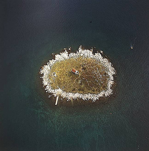
Vnetak Lighthouse is situated in Cres Island. It was built in 1875 by Austro Hungarian Empire. The height of the lighthouse tower is 8.0 meters (26.0 feet). The focal height is 12.0 meters (39.0 feet). The nominal range of the main light is 3.0 nautical miles (6.0 kilometers).Vnetak Lighthouse GPS coordinates
GPS location coordinates: 44°37'9.6"N 14°14'8.5"EOther lighthouses in vicinity of Vnetak Lighthouse:
- Susak Lighthouse in Susak Island is 7.94 miles away.
- Marlera Lighthouse in Medulin is 17.13 miles away.
- Trstenik Lighthouse in Trstenik Islet near Cres is 17.16 miles away.
- Porer Lighthouse in Istria is 19.45 miles away.
- Zaglav Lighthouse in Cres Island is 21.00 miles away.
Marinas in vicinity of Vnetak Lighthouse:
- Marina Losinj in Kvarner at a distance of 11.97 miles.
- Y/C Marina Mali Losinj in Kvarner at a distance of 12.20 miles.
- ACI Marina Pomer in Istria at a distance of 21.52 miles.
- Marina Veruda in Istria at a distance of 24.52 miles.
- ACI Marina Cres in Kvarner at a distance of 24.96 miles.
Neighbouring islands to Vnetak Lighthouse:
- Unije Island at 2.44 miles away.
- Srakane Vele Island at 4.53 miles away.
- Srakane Male Island at 5.99 miles away.
- Susak Island at 7.79 miles away.
- Galijola Island at 8.16 miles away.
- Losinj Island at 8.25 miles away.
- Veli Osir Island at 9.18 miles away.
- Murtar Island at 10.41 miles away.
- Koludarac Island at 10.76 miles away.
- Zeca Island at 11.33 miles away.
Nearest Campsites to Vnetak Lighthouse:
- Rapoca Campsite is at distance of 8.52 miles
- Lopari Campsite is at distance of 8.97 miles
- Preko Mosta Campsite is at distance of 9.18 miles
- Bijar Campsite is at distance of 9.64 miles
- Poljana Campsite is at distance of 11.07 miles
Vnetak Lighthouse Nearby Hotels:
- Hotel Manora in Nerezine (Island Losinj) at a distance of 8.18 miles
- Hotel Televrin in Nerezine at a distance of 8.43 miles
- Pansion Ana in Mali Losinj at a distance of 8.91 miles
- Apartments Marija in Mali Lošinj at a distance of 9.01 miles
- Poljana Camping Village Resort in Mali Losinj at a distance of 11.10 miles
- Guest House Helios in Mali Losinj at a distance of 12.21 miles
