Croatian Islands
Škoji - The Croatian Islands
Baretica Island
Baretica Island Info
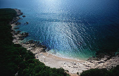
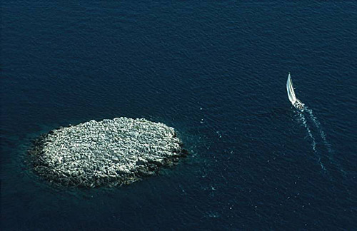
Baretica is an unpopulated island with total area of square meters (m2). The lenght of its coastline is meters. There is no public transport to Baretica.Baretica is small island located between Badija and Planjak. The name 'Baretica' means in English 'Small Hat' reflecting the shape of the island. Baretica has some good spots under the pine trees to enjoy shade during summer heat. However, the rocks on its shores are rough making it difficult to walk around barefoot. Baretica is popular stop for people who like to be near Badija, to be able to watch what's going on there or just pop there to buy drink or food, while still away from its crowds.
| GPS Latitude | 42.94767800 |
|---|---|
| GPS Longitude | 17.16247900 |
| Area(M2) | |
| Coastline Lenght(M) |
Baretica GPS coordinates
GPS location coordinates: 42°56'51.6"N 17°9'44.9"ESome Lighthouses in vicinity of Baretica:
- Sestrica vela (Korcula) Lighthouse in Islet Vela Sestrica near Korcula at a distance of 2.51 miles.
- Sucuraj Lighthouse in Sućuraj, Hvar Island at a distance of 12.36 miles.
- Glavat Lighthouse in Islet Glavat near Lastovo at a distance of 12.60 miles.
- Plocica Lighthouse in Islet Plocica near Korcula at a distance of 18.39 miles.
- Struga Lighthouse in Skrivena Luka, Lastovo Island at a distance of 20.88 miles.
- Sveti Petar Lighthouse in Makarska at a distance of 25.19 miles.
- Sveti Nikola Lighthouse in Pucisca, Brac island at a distance of 35.78 miles.
Marinas in vicinity of Baretica:
- ACI Marina Korcula at a distance of 1.51 miles.
- Marina Solitudo (Lastovo) at a distance of 21.40 miles.
- Marina Ramova ( Baska Voda) at a distance of 27.52 miles.
- ACI Marina Vrboska (Hvar) at a distance of 29.32 miles.
- Marina Baska Voda at a distance of 30.32 miles.
Neighbouring islands to Baretica:
- Planjak Island at 0.32 miles away.
- Kamenjak (Korcula) Island at 0.43 miles away.
- Badija Island at 0.46 miles away.
- Rogacic Island at 0.76 miles away.
- Vrnik Island at 0.98 miles away.
- Lucnjak Island at 1.04 miles away.
- Skrpinjak Island at 1.53 miles away.
- Gubavac (Korcula) Island at 1.57 miles away.
- Sutvara Island at 1.62 miles away.
- Vela Stupa Island at 1.67 miles away.
Nearest Campsites to Baretica:
- Kalac Campsite is at distance of 1.07 miles
- Vela Postrana Campsite is at distance of 1.85 miles
- Trstenica Campsite is at distance of 2.37 miles
- Glavna plaza Campsite is at distance of 2.47 miles
- Palme Campsite is at distance of 2.65 miles
Baretica Nearby Hotels:
- Apartments Tomovic in Lumbarda at a distance of 0.41 miles
- Soline Accommodation in Lumbarda Otok Korčula at a distance of 0.45 miles
- Apartments Ivan & Ana in Korčula at a distance of 0.93 miles
- Hotel Bon Repos in Korcula at a distance of 0.98 miles
- Hostel Dragan's Den in Korčula at a distance of 0.99 miles
- Apartments and Rooms Basic in Korcula at a distance of 1.02 miles
